Scan4Model

Terrestrial Laser Scanner

TLS for Accurate Surveying and BIM Modeling

We capture reality using terrestrial 3D laser scanning to generate accurate point clouds of buildings, industrial facilities, and existing assets. A reliable foundation for engineering, architecture, renovation, and BIM modeling projects.

Escáner láser terrestre 3D

What Can Terrestrial Laser Scanning Do for You?

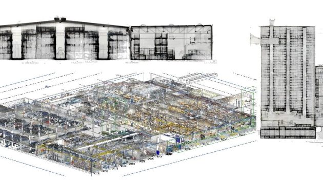
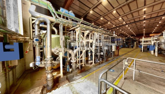
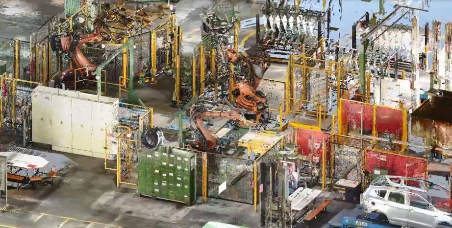
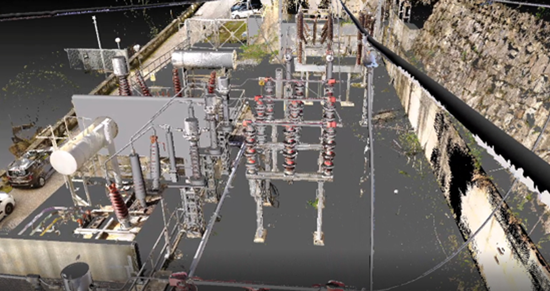
Terrestrial Laser Scanning (TLS) is a reality capture technology that uses laser light pulses to collect millions of three-dimensional points. The result is a point cloud that accurately reproduces the real geometry of buildings, facilities, and infrastructure.

Why scan a facility?

Terrestrial laser scanning enables the rapid and accurate capture of real-world geometry, reducing field errors and improving decision-making throughout every stage of a project.

Projects Captured Using Laser Scanning

Experience in 3D reality capture across a wide range of assets, from industrial facilities and heritage sites to construction projects, infrastructure, and the naval sector.

laser escaner terrestre (5)
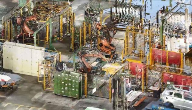
Industry: Over 500,000 m² scanned across complex industrial facilities.
laser escaner terrestre (1)
Logistics: Extensive experience in large warehouses and distribution centers.
laser escaner terrestre (3)
Heritage: Urban centers and architectural heritage.
MEP
Technical Facilities: Plant rooms and MEP environments.

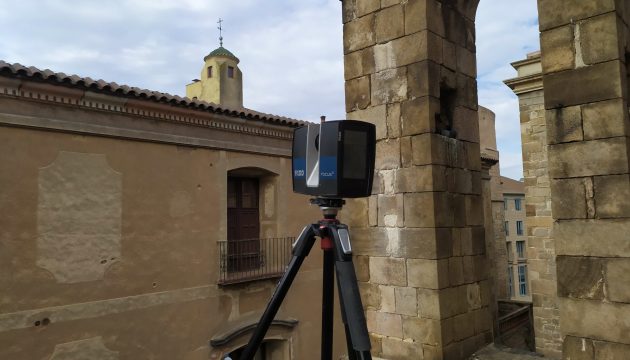
These devices emit laser light pulses and capture their return after reflecting off a surface, allowing them to calculate the geometric position of each point relative to the scanner.

By repeating this process at high speed, up to 2 million points per second, they are capable of generating a three-dimensional representation of the scanned asset or facility.

In addition, as they are typically equipped with high-resolution cameras, color information can be applied to the point cloud, resulting in a geometrically accurate and photorealistic reconstruction of any building or installation.

Sectors Where We Deliver Construction Verification Services

Frequently Asked Questions About Laser Scanning

These are some of the most common questions about laser scanning services and their applications.

What is a point cloud used for?

It serves as the foundation for analysis, measurements, BIM modeling, construction verification, maintenance, and asset digitization.

What is the accuracy of a terrestrial laser scanner?

Accuracy depends on the equipment and scanning settings, but it is typically within the millimeter range. This level of precision is suitable for demanding technical projects such as BIM modeling, dimensional control, and engineering applications. For the inspection of piping systems, ventilation networks, or complex structural elements, having the design model available is often necessary for detailed comparison and verification.

What is delivered after laser scanning?

Depending on the specific requirements of each client. Typically, deliverables include a georeferenced color point cloud and a virtual tour with high-resolution panoramic images captured from each scanner position. From this data, 2D drawings, BIM models, and technical documentation can also be generated according to the needs of the project.

How long does a TLS survey take?

The duration depends on the size of the area, accessibility, and the complexity of the environment. In most projects, field data capture is completed within hours or a few days, significantly reducing timelines compared to traditional surveying methods.

Is it necessary to stop operations during scanning?

Not necessarily. In many cases, scanning can be carried out while operations remain active, with planning adapted to minimize disruptions and interference.

Can laser scanning be performed outdoors?

Yes, although performance depends on factors such as lighting conditions and range. Different technologies can be combined when required by the project.

Nuestro valor competitivo

En Scan4Model combinamos tecnología de captura avanzada con experiencia en proyectos reales, asegurando datos fiables y útiles para equipos técnicos.

No solo capturamos datos: generamos información precisa y útil para proyecto.

Terrestrial Laser Scanner

Fases del servicio de escaneado TLS

Gestionamos cada proyecto de forma estructurada, desde el análisis inicial hasta la entrega final de los datos procesados.

Definición de alcance, precisión requerida y entregables

Resultado de la fase: Planificación del trabajo

Escaneado láser en campo con sistemas láser escáner de alta gama. Combinación si se requiere con otras tecnologías (Slam, fotogrametría, GNSS, estación total…)

Resultado de la fase: Escaneos sin procesar.

Unión, limpieza y georreferenciación de nubes

Resultado de la fase. Nube de puntos completa y coherente

Nubes de puntos, ortofotos, visitas virtuales u otro tipo de datos derivados de ellos según el proyecto.

Resultado de la fase: Documentación lista para uso técnico.

Control de calidad y entrega final y aceptación por parte del cliente.

Resultado de la fase: Datos validados, precisos y confiables listos para ser utilizados en las siguientes fases del proyecto.

Experiencia en digitalización de activos reales

Acumulamos experiencia en escaneado 3D aplicado a múltiples sectores, trabajando con equipos y metodologías que garantizan resultados fiables.

bim & scan to bim

WE'LL BE HAPPY TO HELP YOU

Get in touch with us.

Error: Contact form not found.